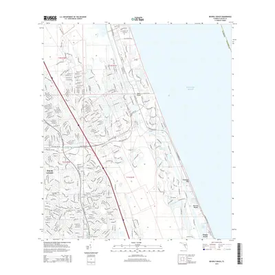
2015 Map of Beverly Beach
USGS Topo · Published 2015About this map
Palm Coast and its dense network of residential subdivisions dominate the western half of this Florida coastal landscape, showing a period of significant suburban expansion between the Atlantic and the inland waterways. The map illustrates a complex system of drainage and navigation, most notably the Intracoastal Waterway and the Matanzas River, which are connected by various man-made features like the Saint Joe Canal and Fox Cut. Along the immediate shoreline, the settlements of Beverly Beach, Painters Hill, and the northern edge of Flagler Beach sit on a narrow strip of land between the marshy interior and the Atlantic Ocean. The interior topography is defined by low-lying wetlands and branches such as Big Mulberry Br and Little Mulberry Br, which drain into Long Cr. This 2015 survey provides a clear view of the modern road network, from major thoroughfares like Matanzas Woods Pky to the winding residential lanes of the growing coastal communities.
Find a feature on this map
362 named features on this map. Tap any name to fly to it.
Don’t see what you’re looking for? This feature index may not catch every label — zoom into the map to look around manually.
Map Details
Editions of this 2015 Beverly Beach Map
This is the sole edition of this map. No revisions or reprints were ever made.
Other maps of this area

1927 · Matanzas
USGS Topo · 1:48,000

1937 · Dinner Island
USGS Topo · 1:48,000

1937 · Ormond
USGS Topo · 1:48,000

1943 · Dinner Island
USGS Topo · 1:62,500

1943 · Matanzas
USGS Topo · 1:62,500

1944 · Ormond
USGS Topo · 1:62,500

1944 · Dinner Island
USGS Topo · 1:62,500

1944 · Matanzas
USGS Topo · 1:62,500

1954 · Daytona Beach
USGS Topo · 1:250,000

1956 · Dinner Island NE
USGS Topo · 1:24,000