
1945 Map of Beverly
USGS Topo · Published 1945About this map
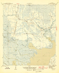
Tates Hell Swamp dominates the northern reaches of this Franklin County landscape, its sprawling wetlands marked by the presence of an Old Logging RR and scattered outposts like Creels Side Camp. The area’s history is tied to the movement of timber and river access, seen in the small settlement of Beverly along the Apalachicola Northern line and isolated river points like Butcher Pen Landing and Gardner Landing. The southern half of the map dissolves into a labyrinth of tidal creeks and marshes, including Whisky George Creek and Montgomery Slough, which feed into East Bay. This coastal transition zone features small centers of community life such as Bethlehem Ch and family-named landmarks like Hays Place, providing a clear view of the rural Florida Panhandle before mid-century modernization altered these remote drainage patterns.
Find a feature on this map
37 named features on this map. Tap any name to fly to it.
Don’t see what you’re looking for? This feature index may not catch every label — zoom into the map to look around manually.
Map Details
Editions of this 1945 Beverly Map
4 editions found
Other maps of this area

1943 · West Pass
USGS Topo · 1:31,680

1943 · Apalachicola
USGS Topo · 1:31,680

1943 · Jackson River
USGS Topo · 1:24,000

1944 · Green Point
USGS Topo · 1:31,680

1944 · Apalachicola
USGS Topo · 1:24,000

1944 · Forbes Island
USGS Topo · 1:24,000

1945 · Forbes Island
USGS Topo · 1:31,680

1945 · Tates Hell Swamp
USGS Topo · 1:31,680

1945 · Jackson River
USGS Topo · 1:31,680

1945 · Fort Gadsden
USGS Topo · 1:31,680