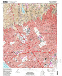
1995 Map of Beverly Hills
USGS Topo · Published 1999About this map
Beverly Hills and the surrounding Westside neighborhoods of Los Angeles are captured here in the late 1990s, showcasing a landscape of high-value real estate and world-famous cultural institutions. The map highlights the sprawling campus of the Univ of California at Los Angeles and the extensive grounds of the Veterans Administration Center and Los Angeles National Cemetery. The urban fabric is defined by legendary thoroughfares like Sunset Blvd and Wilshire Blvd, which connect residential enclaves like Bel Air and Brentwood to the commercial hubs of Century City and West Hollywood. In Culver City, the presence of MGM Studios and Desilu Studios underscores the region's identity as a global entertainment capital. The southern reach of the Santa Monica Mountains transitions into the coastal plains near Santa Monica, where the Santa Monica Pier marks the edge of the Pacific Ocean. Farther inland, clusters of Oil Wells near the Hillcrest Country Club serve as a reminder of the industrial heritage that once dominated the Los Angeles Basin.
Find a feature on this map
82 named features on this map. Tap any name to fly to it.
Don’t see what you’re looking for? This feature index may not catch every label — zoom into the map to look around manually.
Map Details
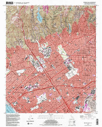
Editions of this 1995 Beverly Hills Map
2 editions found
Other maps of this area

1894 · Los Angeles
USGS Topo · 1:62,500

1896 · Redondo
USGS Topo · 1:62,500

1896 · Santa Monica
USGS Topo · 1:62,500

1898 · Santa Monica
USGS Topo · 1:62,500

1900 · Los Angeles
USGS Topo · 1:62,500

1901 · Southern California Sheet No. 1
USGS Topo · 1:250,000

1902 · Santa Monica
USGS Topo · 1:62,500

1903 · Calabasas
USGS Topo · 1:62,500

1903 · Camulos
USGS Topo · 1:125,000

1904 · Southern California Sheet No. 1
USGS Topo · 1:250,000