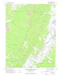
1968 Map of Beverly West
USGS Topo · Published 1977About this map
Rich Mountain dominates the center of this Randolph County landscape, separating the industrial Roaring Creek Valley to the west from the Tygart Valley River settlements to the east. By the late 1960s, the map records a landscape shaped by coal extraction and valley agriculture, with numerous strip mines and mines scarring the western slopes near Harrison. In contrast, the eastern valley floor is a dense corridor of community life along the Western Maryland railroad, linking the towns of Beverly, Dailey, and Valley Bend.
Find a feature on this map
58 named features on this map. Tap any name to fly to it.
Don’t see what you’re looking for? This feature index may not catch every label — zoom into the map to look around manually.
Map Details
Editions of this 1968 Beverly West Map
3 editions found
Other maps of this area

1889 · Beverly
USGS Topo · 1:125,000

1892 · Beverly
USGS Topo · 1:125,000

1893 · Buckhannon
USGS Topo · 1:125,000

1896 · Buckhannon
USGS Topo · 1:125,000

1897 · Buckhannon
USGS Topo · 1:125,000

1909 · Elkins
USGS Topo · 1:62,500

1912 · Sago
USGS Topo · 1:48,000

1913 · Pickens
USGS Topo · 1:48,000

1914 · Sago
USGS Topo · 1:62,500

1915 · Pickens
USGS Topo · 1:62,500