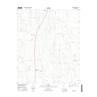
2016 Map of Biardstown
USGS Topo · Published 2016About this map
The rolling plains of Lamar County south of Paris are defined by a network of creek branches and small agricultural settlements. This 2016 survey highlights several rural hubs that historically served the surrounding farmsteads, including Biardstown, Broadway Junction, and Glory. These locations, often established around intersections like FM 1497, remain anchored by their local burying grounds. The map is particularly useful for genealogists, as it identifies numerous family and community landmarks such as Antioch Cem, New Dora Cem, and Brackeen Cem. The landscape is etched by drainage systems like Auds Cr and Hickory Cr, which flow through the pastures and woodlots that characterize this part of Northeast Texas. Small clusters of homes appear at Atlas and Broadway, showing the persistent but dispersed settlement pattern of the region south of the county seat.
Find a feature on this map
71 named features on this map. Tap any name to fly to it.
Don’t see what you’re looking for? This feature index may not catch every label — zoom into the map to look around manually.
Map Details
Editions of this 2016 Biardstown Map
This is the sole edition of this map. No revisions or reprints were ever made.
Other maps of this area

1903 · Paris
USGS Topo · 1:125,000

1948 · Paris
USGS Topo · 1:62,500

1949 · Paris
USGS Topo · 1:62,500

1953 · Texarkana
USGS Topo · 1:250,000

1956 · Texarkana
USGS Topo · 1:250,000

1963 · Minter
USGS Topo · 1:24,000

1964 · Pattonville
USGS Topo · 1:24,000

1964 · Blossom
USGS Topo · 1:24,000

1964 · Charleston
USGS Topo · 1:24,000

1964 · Cooper North
USGS Topo · 1:24,000