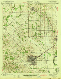
1943 Map of Bicknell
USGS Topo · Published 1943About this map
The Indiana coalfields of Knox County define this 1941 landscape, where the dense concentration of extraction sites around Bicknell illustrates the height of the region's mining era. A network of pits and shafts, including the Sunshine Mine, North Side Mine, and Lynn Mine, surrounds the town, connected by the Pennsylvania railroad. This industrial activity contrasts with the agricultural patterns further north near Freelandville, where small country landmarks like Bethel Ch and Walker Cem indicate a long-established rural community.
Find a feature on this map
38 named features on this map. Tap any name to fly to it.
Don’t see what you’re looking for? This feature index may not catch every label — zoom into the map to look around manually.
Map Details
Editions of this 1943 Bicknell Map
2 editions found
Other maps of this area

1942 · Fritchton
USGS Topo · 1:24,000

1943 · Carlisle
USGS Topo · 1:24,000

1943 · Oaktown
USGS Topo · 1:24,000

1943 · Sandborn
USGS Topo · 1:24,000

1943 · Bicknell
USGS Topo · 1:24,000

1943 · Plainville
USGS Topo · 1:24,000

1944 · Bucktown
USGS Topo · 1:24,000

1944 · Fritchton
USGS Topo · 1:24,000

1944 · Washington
USGS Topo · 1:24,000

1944 · Wheatland
USGS Topo · 1:24,000