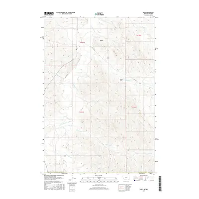
2017 Map of Biddle
USGS Topo · Published 2017About this map
Biddle serves as the primary settlement hub in this rural corner of Powder River County, where the drainage of the Little Powder River shapes the local topography. The landscape is defined by a dense network of coulees and named drainages such as Prairie Dog Cr, Hay Cr, and Ranch Cr, which cut through the high plains. Historically significant routes including Ranch Creek Rd and Rumph Rd provide access to the various gulches that characterize the terrain, notably Wilson Gulch and Rambo Gulch. This 2017 survey reflects the enduring character of Montana's ranching country, showing the intersection of established township boundaries and natural features like Fuller Gulch and Deer Trail Cr. The mapping of these minor waterways and named topographical depressions is invaluable for tracing land use and property history in this sparsely populated region.
Find a feature on this map
28 named features on this map. Tap any name to fly to it.
Don’t see what you’re looking for? This feature index may not catch every label — zoom into the map to look around manually.
Map Details
Editions of this 2017 Biddle Map
This is the sole edition of this map. No revisions or reprints were ever made.
Other maps of this area

1954 · Ekalaka
USGS Topo · 1:250,000

1954 · Gillette
USGS Topo · 1:250,000

1955 · Gillette
USGS Topo · 1:250,000

1956 · Ekalaka
USGS Topo · 1:250,000

1958 · Gillette
USGS Topo · 1:250,000

1958 · Ekalaka
USGS Topo · 1:250,000

1962 · Gillette
USGS Topo · 1:250,000

1965 · Ekalaka
USGS Topo · 1:250,000

1970 · Pine Creek
USGS Topo · 1:24,000

1970 · Sanburn Reservoir
USGS Topo · 1:24,000