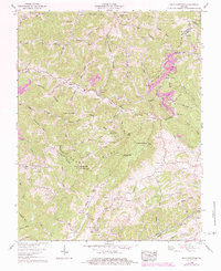
1958 Map of Big A Mountain
USGS Topo · Published 1984About this map
Big A Mountain dominates the central landscape of this southwest Virginia survey, marking the intersection of the Buchanan and Russell County lines. The high-altitude terrain is defined by the Tennessee Valley Divide, where steep hollows and branches like Jakes Fork and Hurricane Creek flow north and south from the ridgelines. Small mountain communities like Council and Venia are connected by narrow roads following the creek beds, while higher elevations are marked by isolated landmarks like the Big A Lookout Tower.
Find a feature on this map
114 named features on this map. Tap any name to fly to it.
Don’t see what you’re looking for? This feature index may not catch every label — zoom into the map to look around manually.
Map Details
Editions of this 1958 Big A Mountain Map
Other maps of this area

1886 · Grundy
USGS Topo · 1:125,000

1890 · Grundy
USGS Topo · 1:125,000

1891 · Tazewell
USGS Topo · 1:125,000

1891 · Abingdon
USGS Topo · 1:125,000

1892 · Grundy
USGS Topo · 1:125,000

1894 · Abingdon
USGS Topo · 1:125,000

1895 · Tazewell
USGS Topo · 1:125,000

1897 · Tazewell
USGS Topo · 1:125,000

1897 · Bristol
USGS Topo · 1:125,000

1902 · Bristol
USGS Topo · 1:125,000