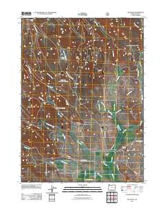
2011 Map of Big Baldy
USGS Topo · Published 2011About this map
Big Baldy and Little Baldy anchor this high-altitude landscape in Lake County, Oregon, where a series of ranching properties and forest camps follow the drainages of the Fremont-Winema National Forest. Named homesteads and camps, including Mendell Ranch, Maxwell Ranch, Hotchkiss Ranch, and McDonald Camp, are concentrated along the lower reaches of Thomas Creek and Cox Creek. The intricate network of forest service roads like NFD 3710 RD and NFD 3613 RD reveals the active management of this timber and grazing land. The presence of the Withrotor Airport near the southeastern edge suggests a modern logistical hub for this remote interior. Water management is evident through features like Hotchkiss Ditch, which redirects flow from the high mountain meadows of Snyder Meadow and Lynch Flat to the lower valleys.
Find a feature on this map
38 named features on this map. Tap any name to fly to it.
Don’t see what you’re looking for? This feature index may not catch every label — zoom into the map to look around manually.
Map Details
Editions of this 2011 Big Baldy Map
This is the sole edition of this map. No revisions or reprints were ever made.
Other maps of this area

1955 · Klamath Falls
USGS Topo · 1:250,000

1958 · Klamath Falls
USGS Topo · 1:250,000

1964 · Lakeview NE
USGS Topo · 1:24,000

1964 · Crooked Creek Valley
USGS Topo · 1:24,000

1964 · Valley Falls
USGS Topo · 1:24,000

1964 · Cox Flat
USGS Topo · 1:24,000

1964 · Lakeview NW
USGS Topo · 1:24,000

1964 · Shoestring Butte
USGS Topo · 1:24,000

1964 · Drews Gap
USGS Topo · 1:24,000

1964 · Clover Flat
USGS Topo · 1:24,000