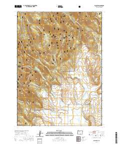
2020 Map of Big Baldy
USGS Topo · Published 2020About this map
Fremont National Forest dominates this high-elevation landscape in Lake County, where steep drainage networks define the terrain of the Big Baldy and Little Baldy peaks. The map reveals an intricate system of forest development roads, including the Natl Forest Develop Road 3613 Rd, which provides access to remote landmarks such as Lynch Flat and Snyder Meadow. In the southern portion of the quadrangle, the terrain transitions into the more level reaches of the Hart Mountain National Antelope Refuge.
Find a feature on this map
42 named features on this map. Tap any name to fly to it.
Don’t see what you’re looking for? This feature index may not catch every label — zoom into the map to look around manually.
Map Details
Editions of this 2020 Big Baldy Map
This is the sole edition of this map. No revisions or reprints were ever made.
Other maps of this area

1955 · Klamath Falls
USGS Topo · 1:250,000

1958 · Klamath Falls
USGS Topo · 1:250,000

1964 · Lakeview NE
USGS Topo · 1:24,000

1964 · Crooked Creek Valley
USGS Topo · 1:24,000

1964 · Valley Falls
USGS Topo · 1:24,000

1964 · Cox Flat
USGS Topo · 1:24,000

1964 · Lakeview NW
USGS Topo · 1:24,000

1964 · Shoestring Butte
USGS Topo · 1:24,000

1964 · Drews Gap
USGS Topo · 1:24,000

1964 · Clover Flat
USGS Topo · 1:24,000