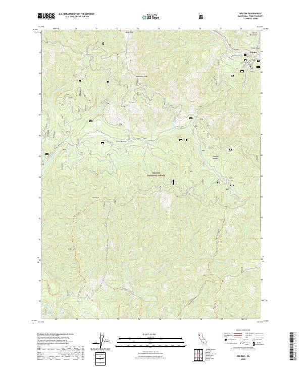
2022 Map of Big Bar
USGS Topo · Published 2022About this map
Big Bar and the Pattison Ranch anchor this study of the Trinity Mountains, where human settlement is concentrated along the narrow riparian corridor of the Trinity Wild and Scenic River. The map reveals a landscape defined by sharp elevation changes, from the heights of Monument Peak and Eagle Rock to the deep drainages of Hayshed Creek and Hayfork Creek. Local history is preserved in names like Price Creek Cem and the grazing grounds at Haypress Meadow and Corral Bottom. A network of historic paths and access routes, including the Pattison Peak Trl and Corral Bottom Rd, navigate the steep grades of Treloar Ridge and Gates Mtn. This record shows how topography has dictated the placement of homesteads and resource management within the Trinity National Forest.
Find a feature on this map
53 named features on this map. Tap any name to fly to it.
Don’t see what you’re looking for? This feature index may not catch every label — zoom into the map to look around manually.
Map Details
Editions of this 2022 Big Bar Map
This is the sole edition of this map. No revisions or reprints were ever made.
Other maps of this area

1909 · Big Bar
USGS Topo · 1:96,000

1915 · Big Bar and Vicinity
USGS Topo · 1:250,000

1951 · Hayfork
USGS Topo · 1:62,500

1951 · Helena
USGS Topo · 1:62,500

1951 · Hyampom
USGS Topo · 1:62,500

1951 · Ironside Mountain
USGS Topo · 1:62,500

1958 · Redding
USGS Topo · 1:250,000

1982 · Helena
USGS Topo · 1:24,000
1982 · Big Bar
USGS Topo · 1:24,000
1982 · Hayfork Bally
USGS Topo · 1:24,000