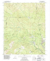
1991 Map of Big Basin
USGS Topo · Published 1995About this map
The San Mateo Co Santa Cruz Co boundary divides this landscape of redwood-shaded canyons and coastal ridges. Big Basin Redwoods State Park dominates the central terrain, centered on the Park Headquarters and surrounded by a network of drainage systems including Waddell Creek and Opal Creek. The map documents a mix of conservation and development, where protected areas like the West Waddell Creek State Wilderness sit adjacent to residential enclaves such as Riverside Grove and Forest Springs along the San Lorenzo River.
Find a feature on this map
58 named features on this map. Tap any name to fly to it.
Don’t see what you’re looking for? This feature index may not catch every label — zoom into the map to look around manually.
Map Details
Editions of this 1991 Big Basin Map
2 editions found
Other maps of this area

1897 · Palo Alto
USGS Topo · 1:62,500

1899 · Palo Alto
USGS Topo · 1:62,500

1902 · Santa Cruz
USGS Topo · 1:125,000

1940 · Halfmoon Bay
USGS Topo · 1:62,500

1940 · Ano Nuevo
USGS Topo · 1:62,500

1941 · Ano Nuevo Pt.
USGS Topo · 1:62,500

1941 · Palo Alto
USGS Topo · 1:62,500

1942 · Ano Nuevo
USGS Topo · 1:62,500

1943 · Palo Alto
USGS Topo · 1:62,500

1943 · Halfmoon Bay
USGS Topo · 1:62,500