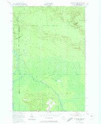
1951 Map of Big Beaver Creek
USGS Topo · Published 1974About this map
The Tahquamenon River and its intricate tributaries dominate this mid-century survey of the Upper Peninsula wilderness. At a time when this landscape was primarily defined by logging and seasonal recreation, the map records specialized outposts like Cadillac Camp 14 and Alder Camp, alongside sporting retreats such as Buckhorn Lodge and the Maple Ridge Club. The terrain is a complex network of wetlands and drainage basins, where Little Beaver Creek and the East Branch Big Beaver Creek converge before feeding into the larger river systems. The administrative intersection of Luce and Chippewa Counties is clearly delineated, crossing through dense sections of the Hiawatha National Forest and the Lake Superior State Forest. The simple naming of East and West Road highlights the sparse infrastructure of the era, reflecting a region where geography was navigated via river branches and secluded camps rather than a dense road network.
Find a feature on this map
19 named features on this map. Tap any name to fly to it.
Don’t see what you’re looking for? This feature index may not catch every label — zoom into the map to look around manually.
Map Details
Editions of this 1951 Big Beaver Creek Map
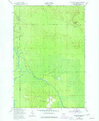
Other maps of this area

1951 · Emerson
USGS Topo · 1:24,000

1951 · Piatt Lake
USGS Topo · 1:24,000

1951 · Big Beaver Creek
USGS Topo · 1:24,000

1951 · Hulbert
USGS Topo · 1:24,000

1951 · Eckerman
USGS Topo · 1:24,000

1951 · Timberlost
USGS Topo · 1:24,000

1951 · Eckerman
USGS Topo · 1:62,500

1951 · Shelldrake
USGS Topo · 1:62,500

1954 · Sault Sainte Marie
USGS Topo · 1:250,000

1956 · Sault Sainte Marie
USGS Topo · 1:250,000