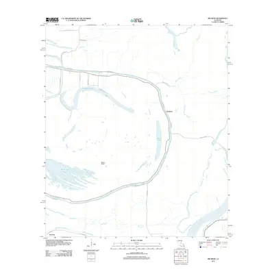
2012 Map of Big Bend
USGS Topo · Published 2012About this map
Bayou des Glaises snakes across this low-lying landscape, defining the character of the settlements at Big Bend and Red Fish. The map illustrates a complex alluvial environment where old river channels and ridges dictate the placement of local infrastructure like Old Highway 1 and Hamburg RD. This area is dominated by significant water bodies, including the wide Horseshoe Lake and the fragmented waters of Sutton Lake and Belson Lake, which are separated by the subtle rise of Sutton Ridge.
Find a feature on this map
27 named features on this map. Tap any name to fly to it.
Don’t see what you’re looking for? This feature index may not catch every label — zoom into the map to look around manually.
Map Details
Editions of this 2012 Big Bend Map
This is the sole edition of this map. No revisions or reprints were ever made.
Other maps of this area

1939 · Artonish
USGS Topo · 1:62,500

1941 · Voorhies
USGS Topo · 1:62,500

1941 · Batchelor
USGS Topo · 1:62,500

1953 · Natchez
USGS Topo · 1:250,000

1954 · Artonish
USGS Topo · 1:62,500

1954 · Baton Rouge
USGS Topo · 1:250,000

1955 · Artonish
USGS Topo · 1:62,500

1955 · Batchelor
USGS Topo · 1:62,500

1955 · Odenburg
USGS Topo · 1:62,500

1956 · Natchez
USGS Topo · 1:250,000