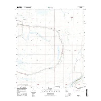
2015 Map of Big Bend
USGS Topo · Published 2015About this map
The Atchafalaya River winds through the southeastern corner of this landscape, marking the boundary between Avoyelles Parish and Pointe Coupee Parish. This region is defined by a dense network of waterways and wetlands, including Bayou des Glaises, which snakes across the northern portion of the map near the settlement of Big Bend. The land is dotted with numerous small lakes and bayous, such as Lac Patassa, Belson Lake, and Tilden Lake, illustrating the complex hydrology of the Louisiana river basin. Roadways like La-451 and Hamburg Rd follow the natural levees and ridges, providing access to small communities like Red Fish and Sutton Ridge. The presence of the Simmesport Hunting Club Rd suggests the area's ongoing use for recreational land management within this intricate alluvial environment.
Find a feature on this map
40 named features on this map. Tap any name to fly to it.
Don’t see what you’re looking for? This feature index may not catch every label — zoom into the map to look around manually.
Map Details
Editions of this 2015 Big Bend Map
This is the sole edition of this map. No revisions or reprints were ever made.
Other maps of this area

1939 · Artonish
USGS Topo · 1:62,500

1941 · Voorhies
USGS Topo · 1:62,500

1941 · Batchelor
USGS Topo · 1:62,500

1953 · Natchez
USGS Topo · 1:250,000

1954 · Artonish
USGS Topo · 1:62,500

1954 · Baton Rouge
USGS Topo · 1:250,000

1955 · Artonish
USGS Topo · 1:62,500

1955 · Batchelor
USGS Topo · 1:62,500

1955 · Odenburg
USGS Topo · 1:62,500

1956 · Natchez
USGS Topo · 1:250,000