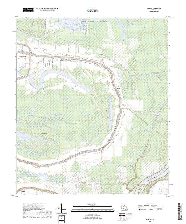
2024 Map of Big Bend
USGS Topo · Published 2024About this map
Bordelonville and Big Bend anchor this low-lying landscape within the intricate alluvial network of the Atchafalaya River basin. The geography is defined by a dense system of waterways, where the meandering Bayou des Glaises traces the edge of the community before turning south toward Red Fish. The presence of Pomme De Terre Swamp and numerous seasonal water bodies like Lac Patassa, Belson Lake, and Sutton Lake illustrates the persistent wetland character of Avoyelles Parish. Land use is restricted by this hydrology, with local roads like N Bayou Des Glaises Rd and Big Bend Rd following the natural levees. Rising slightly above the surrounding wetlands, Sutton Ridge provides a rare point of relief in a territory dominated by bayous and cypress breaks, reflecting the historical pattern of settlement on the highest available ground.
Find a feature on this map
43 named features on this map. Tap any name to fly to it.
Don’t see what you’re looking for? This feature index may not catch every label — zoom into the map to look around manually.
Map Details
Editions of this 2024 Big Bend Map
This is the sole edition of this map. No revisions or reprints were ever made.
Other maps of this area

1939 · Artonish
USGS Topo · 1:62,500

1941 · Voorhies
USGS Topo · 1:62,500

1941 · Batchelor
USGS Topo · 1:62,500

1953 · Natchez
USGS Topo · 1:250,000

1954 · Artonish
USGS Topo · 1:62,500

1954 · Baton Rouge
USGS Topo · 1:250,000

1955 · Artonish
USGS Topo · 1:62,500

1955 · Batchelor
USGS Topo · 1:62,500

1955 · Odenburg
USGS Topo · 1:62,500

1956 · Natchez
USGS Topo · 1:250,000