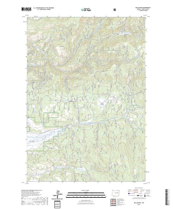
2023 Map of Big Canyon
USGS Topo · Published 2023About this map
The Strawberry Mountain Wilderness defines the northern reaches of this landscape, where the Strawberry Range transitions into the high-elevation drainages of Grant County. This region is characterized by a dense network of mountain water sources, including Canyon Creek Meadow and dozens of named springs such as Chamber Spring and Seagull Spring. To the west, the Aldrich Mountains rise above the deep cut of Big Canyon, while the southern portion of the sheet opens into Bear Valley. Human presence is marked primarily by high-altitude meadows like Powell Meadow and the transit route of the Natl Forest Develop Road 16 Rd, which winds through the Malheur National Forest. The map captures a high-desert mountain environment where seasonal grazing and wilderness preservation meet at features like Wendling Glade and the Big Bend of the terrain.
Find a feature on this map
39 named features on this map. Tap any name to fly to it.
Don’t see what you’re looking for? This feature index may not catch every label — zoom into the map to look around manually.
Map Details
Editions of this 2023 Big Canyon Map
This is the sole edition of this map. No revisions or reprints were ever made.
Other maps of this area

1940 · John Day
USGS Topo · 1:62,500

1943 · John Day
USGS Topo · 1:62,500

1955 · Canyon City
USGS Topo · 1:250,000

1959 · Canyon City
USGS Topo · 1:250,000

1959 · Prairie City
USGS Topo · 1:62,500

1961 · Logan Valley
USGS Topo · 1:62,500

1961 · Seneca
USGS Topo · 1:62,500

1972 · Canyon Mtn
USGS Topo · 1:24,000
1972 · Pine Creek Mtn
USGS Topo · 1:24,000

1978 · John Day
USGS Topo · 1:100,000