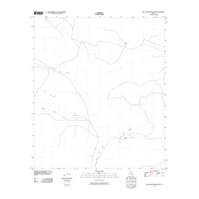
2010 Map of Big Canyon Ranch NW
USGS Topo · Published 2010About this map
Thorn Ranch and Mitchell Ranch anchor this landscape in Pecos County, illustrating the isolated ranching outposts that define the Trans-Pecos region of West Texas. The geography is dominated by the massive drainage system of Big Canyon and its tributaries, including the Middle Fork Big Canyon and Clark Place Draw. These ephemeral waterways have carved deep channels through the arid terrain, leading up toward the prominent Big Divide. Transportation in this sparsely populated area is restricted to the corridor of Hwy 285 and private ranch roads like Mitchell Rn Rd. This 2010 survey highlights the intersection of modern infrastructure and traditional land use, where vast acreages are managed from central ranch hubs positioned near vital water drainage points.
Find a feature on this map
8 named features on this map. Tap any name to fly to it.
Don’t see what you’re looking for? This feature index may not catch every label — zoom into the map to look around manually.
Map Details
Editions of this 2010 Big Canyon Ranch NW Map
This is the sole edition of this map. No revisions or reprints were ever made.
Other maps of this area

1920 · Longfellow
USGS Topo · 1:125,000

1928 · Sanderson
USGS Topo · 1:125,000

1928 · Comanche Spring
USGS Topo · 1:125,000

1929 · Independence Draw Quadrangle
USGS Topo · 1:125,000

1954 · Fort Stockton
USGS Topo · 1:250,000

1958 · Fort Stockton
USGS Topo · 1:250,000

1968 · Busher Canyon
USGS Topo · 1:24,000

1968 · Toms Canyon
USGS Topo · 1:24,000

1969 · Big Canyon Ranch
USGS Topo · 1:24,000

1969 · Big Canyon Ranch NW
USGS Topo · 1:24,000