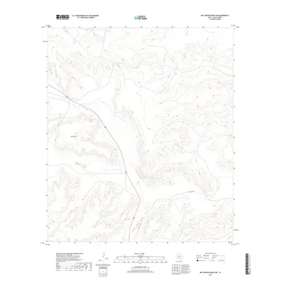
2019 Map of Big Canyon Ranch NW
USGS Topo · Published 2019About this map
Big Divide dominates the high ground in this arid section of Pecos County, serving as a significant topographical marker for the surrounding drainage systems. The landscape is defined by its dramatic relief, where the high plateau is incised by several major dry washes, including Cliett Draw and the extensive Big Canyon. Human presence is largely defined by the winding path of Highway 285, which cuts through the terrain alongside ranching infrastructure like Mitchell Rn Rd. The map illustrates the specialized water management of the West Texas landscape, showing how seasonal runoff is funneled through features such as Clark Place Draw. This 2019 survey provides a modern record of the land use and natural hydrology in a region where topography dictates transportation and ranch boundaries.
Find a feature on this map
6 named features on this map. Tap any name to fly to it.
Don’t see what you’re looking for? This feature index may not catch every label — zoom into the map to look around manually.
Map Details
Editions of this 2019 Big Canyon Ranch NW Map
This is the sole edition of this map. No revisions or reprints were ever made.
Other maps of this area

1920 · Longfellow
USGS Topo · 1:125,000

1928 · Sanderson
USGS Topo · 1:125,000

1928 · Comanche Spring
USGS Topo · 1:125,000

1929 · Independence Draw Quadrangle
USGS Topo · 1:125,000

1954 · Fort Stockton
USGS Topo · 1:250,000

1958 · Fort Stockton
USGS Topo · 1:250,000

1968 · Busher Canyon
USGS Topo · 1:24,000

1968 · Toms Canyon
USGS Topo · 1:24,000

1969 · Big Canyon Ranch
USGS Topo · 1:24,000

1969 · Big Canyon Ranch NW
USGS Topo · 1:24,000