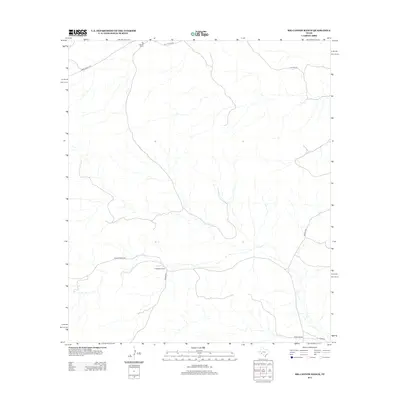
2012 Map of Big Canyon Ranch
USGS Topo · Published 2012About this map
Big Canyon Ranch anchors this high-desert landscape in Pecos County, where the terrain is defined by deep drainage systems and long-established cattle operations. In the southern portion of the sheet, the Hagelstein Ranch and Dudley Ranch reveal the sparse, family-based settlement patterns typical of this part of West Texas in the early 21st century. The map highlights a network of remote corridors including Ranch Road 2400 and Big Canyon Rd, which follow the natural contours of the arroyos. Smaller routes such as Huckaby Rd and Walker Rd branch off to reach isolated parts of the range, illustrating the scale and connectivity required for modern ranching in a territory where water and distance dictate the placement of every road and structure.
Find a feature on this map
10 named features on this map. Tap any name to fly to it.
Don’t see what you’re looking for? This feature index may not catch every label — zoom into the map to look around manually.
Map Details
Editions of this 2012 Big Canyon Ranch Map
This is the sole edition of this map. No revisions or reprints were ever made.
Other maps of this area

1928 · Sanderson
USGS Topo · 1:125,000

1954 · Fort Stockton
USGS Topo · 1:250,000

1958 · Fort Stockton
USGS Topo · 1:250,000

1969 · Circle Dot Ranch
USGS Topo · 1:24,000

1969 · Sanderson
USGS Topo · 1:24,000

1969 · Big Canyon Ranch
USGS Topo · 1:24,000

1969 · Big Canyon Ranch NW
USGS Topo · 1:24,000
1969 · Big Canyon Ranch SW
USGS Topo · 1:24,000

1969 · Dryden NW
USGS Topo · 1:24,000
1969 · Sanderson NE
USGS Topo · 1:24,000