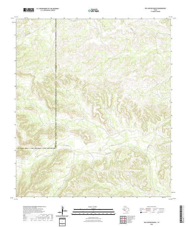
2022 Map of Big Canyon Ranch
USGS Topo · Published 2022About this map
The Pecos Co / Terrell Co boundary line bisects this arid West Texas landscape, cutting through a region defined by extensive drainage networks and ranch access routes. The primary hydrological feature is Downie Draw, which snakes across the southern portion of the quadrangle. The lack of traditional town centers highlights the remote ranching character of the land, where infrastructure is limited to a skeleton of named roads. These include Big Canyon Rd in the north and a cluster of local routes like Dudley Ranch Rd and Walker Rd near the southern boundary. The topography is marked by deeply incised canyons and draws, illustrating the natural erosion patterns of the Edwards Plateau. This map provides a clear record of land division and property access in a sparsely populated corner of the state, where the names on the land reflect individual family ranching legacies.
Find a feature on this map
10 named features on this map. Tap any name to fly to it.
Don’t see what you’re looking for? This feature index may not catch every label — zoom into the map to look around manually.
Map Details
Editions of this 2022 Big Canyon Ranch Map
This is the sole edition of this map. No revisions or reprints were ever made.
Other maps of this area

1928 · Sanderson
USGS Topo · 1:125,000

1954 · Fort Stockton
USGS Topo · 1:250,000

1958 · Fort Stockton
USGS Topo · 1:250,000

1969 · Circle Dot Ranch
USGS Topo · 1:24,000

1969 · Sanderson
USGS Topo · 1:24,000

1969 · Big Canyon Ranch
USGS Topo · 1:24,000

1969 · Big Canyon Ranch NW
USGS Topo · 1:24,000
1969 · Big Canyon Ranch SW
USGS Topo · 1:24,000

1969 · Dryden NW
USGS Topo · 1:24,000
1969 · Sanderson NE
USGS Topo · 1:24,000