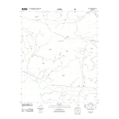
2011 Map of Big Cedar
USGS Topo · Published 2011About this map
Big Cedar serves as the primary settlement hub in this southeastern Oklahoma landscape, where the Kiamichi River and Big Cedar Creek converge. The terrain is defined by the significant elevations of Winding Stair Mountain, Bowman Mountain, and Rough Mountain, which dictate the paths of early roads and watercourses. This 2011 survey documents a region heavily utilized for forestry and recreation, evidenced by several established sites including Thief Spring Campground and Billy Creek Campground.
Find a feature on this map
28 named features on this map. Tap any name to fly to it.
Don’t see what you’re looking for? This feature index may not catch every label — zoom into the map to look around manually.
Map Details
Editions of this 2011 Big Cedar Map
This is the sole edition of this map. No revisions or reprints were ever made.
Other maps of this area

1900 · Winding Stair
USGS Topo · 1:125,000

1909 · Winding Stair
USGS Topo · 1:125,000

1950 · Mcalester
USGS Topo · 1:250,000

1959 · Page
USGS Topo · 1:62,500

1959 · Heavener
USGS Topo · 1:62,500

1962 · McAlester
USGS Topo · 1:250,000

1965 · McAlester
USGS Topo · 1:250,000
1966 · Muse
USGS Topo · 1:24,000
1966 · Leflore SE
USGS Topo · 1:24,000
1966 · Ludlow
USGS Topo · 1:24,000