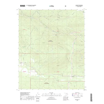
2018 Map of Big Cedar
USGS Topo · Published 2018About this map
Big Cedar serves as the focal point of this survey, situated at the junction of US Hwy 259 and the winding Kiamichi River. This portion of the Ouachita National Forest is defined by a dense network of ridges and watercourses, including the heights of Winding Stair Mtn and Bowman Mtn. The landscape is etched with significant historical and recreational paths, from the Choctaw Nation Trail to the high-elevation Mountain Top Trail.
Find a feature on this map
45 named features on this map. Tap any name to fly to it.
Don’t see what you’re looking for? This feature index may not catch every label — zoom into the map to look around manually.
Map Details
Editions of this 2018 Big Cedar Map
This is the sole edition of this map. No revisions or reprints were ever made.
Other maps of this area

1900 · Winding Stair
USGS Topo · 1:125,000

1909 · Winding Stair
USGS Topo · 1:125,000

1950 · Mcalester
USGS Topo · 1:250,000

1959 · Page
USGS Topo · 1:62,500

1959 · Heavener
USGS Topo · 1:62,500

1962 · McAlester
USGS Topo · 1:250,000

1965 · McAlester
USGS Topo · 1:250,000
1966 · Muse
USGS Topo · 1:24,000
1966 · Leflore SE
USGS Topo · 1:24,000
1966 · Ludlow
USGS Topo · 1:24,000