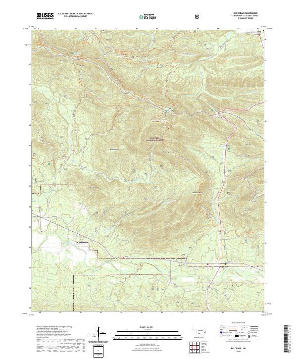
2022 Map of Big Cedar
USGS Topo · Published 2022About this map
Big Cedar sits at the southern edge of this study, nestled at the confluence of Big Cedar Cr and the Kiamichi River. This 2022 survey documents a landscape dominated by the peaks and valleys of the Ouachita National Forest, where high ridges like Winding Stair Mtn and Tram Ridge define the northern horizon. The area's character is shaped by its extensive network of named pathways, including the Ouachita National Recreation Trl and the Horsethief Springs Trl. These routes follow the natural contours of the land, connecting landmarks such as Horse Thief Spring and Pipe Spring. For local historians and genealogists, the map provides a precise location for the Big Cedar Cem and traces the intricate drainage patterns of Billy Cr and Little Cedar Cr, offering a detailed view of the terrain before modern development reaches these forest heights.
Find a feature on this map
53 named features on this map. Tap any name to fly to it.
Don’t see what you’re looking for? This feature index may not catch every label — zoom into the map to look around manually.
Map Details
Editions of this 2022 Big Cedar Map
This is the sole edition of this map. No revisions or reprints were ever made.
Other maps of this area

1900 · Winding Stair
USGS Topo · 1:125,000

1909 · Winding Stair
USGS Topo · 1:125,000

1950 · Mcalester
USGS Topo · 1:250,000

1959 · Page
USGS Topo · 1:62,500

1959 · Heavener
USGS Topo · 1:62,500

1962 · McAlester
USGS Topo · 1:250,000

1965 · McAlester
USGS Topo · 1:250,000
1966 · Muse
USGS Topo · 1:24,000
1966 · Leflore SE
USGS Topo · 1:24,000
1966 · Ludlow
USGS Topo · 1:24,000