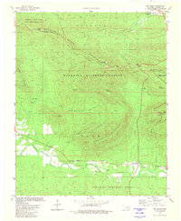
1981 Map of Big Cedar
USGS Topo · Published 1981About this map
Winding Stair Mountain dominates this portion of the Ouachita National Forest in the early 1980s, serving as a backdrop for the transition from the high ridges to the Kiamichi River valley. The presence of Houston Tram Ridge suggests the legacy of early 20th-century logging operations that once moved timber through these steep corridors. The Talimena Scenic Drive follows the crest, connecting recreation points like Horse Thief Spring Campground and the Winding Stair Campground.
Find a feature on this map
33 named features on this map. Tap any name to fly to it.
Don’t see what you’re looking for? This feature index may not catch every label — zoom into the map to look around manually.
Map Details
Editions of this 1981 Big Cedar Map
This is the sole edition of this map. No revisions or reprints were ever made.
Other maps of this area

1900 · Winding Stair
USGS Topo · 1:125,000

1909 · Winding Stair
USGS Topo · 1:125,000

1950 · Mcalester
USGS Topo · 1:250,000

1959 · Page
USGS Topo · 1:62,500

1959 · Heavener
USGS Topo · 1:62,500

1962 · McAlester
USGS Topo · 1:250,000

1965 · McAlester
USGS Topo · 1:250,000

1966 · Muse
USGS Topo · 1:24,000
1966 · Leflore SE
USGS Topo · 1:24,000
1966 · Ludlow
USGS Topo · 1:24,000