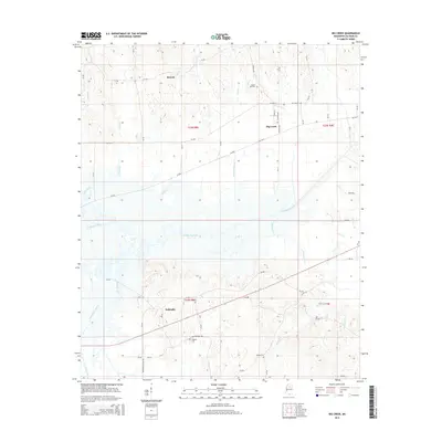
2015 Map of Big Creek
USGS Topo · Published 2015About this map
The Yalobusha River meanders across this Calhoun County landscape, defining a network of tributaries including Sabougla Creek, Shutispear Cr, and Coles Creek. The settlement of Big Creek serves as a local hub near the confluence of Lickup Cr and the river, where streets like S Cotton Blvd and W Main St mark the town center. Further south, the community of Sabougla is situated along CR-346, while the small locality of Retreat lies to the northwest near Gaines Cr.
Find a feature on this map
65 named features on this map. Tap any name to fly to it.
Don’t see what you’re looking for? This feature index may not catch every label — zoom into the map to look around manually.
Map Details
Editions of this 2015 Big Creek Map
This is the sole edition of this map. No revisions or reprints were ever made.
Other maps of this area

1953 · Walthall
USGS Topo · 1:62,500

1953 · West Point
USGS Topo · 1:250,000

1954 · Pittsboro
USGS Topo · 1:62,500

1954 · Duck Hill
USGS Topo · 1:62,500

1955 · Coffeeville
USGS Topo · 1:62,500

1958 · West Point
USGS Topo · 1:250,000

1963 · West Point
USGS Topo · 1:250,000
1976 · Pittsboro SE
USGS Topo · 1:24,000
1976 · Pittsboro NE
USGS Topo · 1:24,000
1976 · Walthall NE
USGS Topo · 1:24,000