
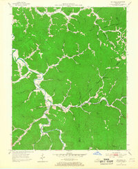
1953 Map of Big Creek
USGS Topo · Published 1954About this map
Red Bird River winds through this central Kentucky landscape, carving a deep valley that serves as the primary corridor for settlement in the early 1950s. Small mountain communities like Big Creek and Eriline are connected by narrow roads following the water, while numerous country schools such as Jacks Creek Sch and Bear Branch Sch dot the various forks and branches. The terrain reveals the early impact of extractive industry, with several Strip Mines and Strip Mine operations appearing on the slopes near Ulysses Creek.
Find a feature on this map
70 named features on this map. Tap any name to fly to it.
Don’t see what you’re looking for? This feature index may not catch every label — zoom into the map to look around manually.
Map Details
Editions of this 1953 Big Creek Map
2 editions found
Other maps of this area

1891 · Manchester
USGS Topo · 1:125,000

1891 · Hazard
USGS Topo · 1:125,000

1913 · Buckhorn
USGS Topo · 1:62,500

1916 · Hyden
USGS Topo · 1:48,000

1919 · Hyden
USGS Topo · 1:62,500

1953 · Buckhorn
USGS Topo · 1:24,000

1953 · Oneida
USGS Topo · 1:24,000

1953 · Hyden West
USGS Topo · 1:24,000

1953 · Mistletoe
USGS Topo · 1:24,000

1954 · Barcreek
USGS Topo · 1:24,000