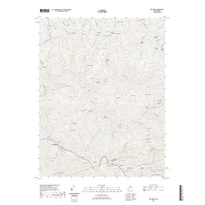
2019 Map of Big Creek
USGS Topo · Published 2019About this map
Guyandotte Water Trail flows through the southern portion of this Lincoln and Logan County borderland, passing the communities of Ferrellsburg and Big Creek. The landscape is defined by a dense network of hollows and ridges, such as Turtletick Hollow and Pea Ridge, which have long shaped the settlement patterns of this West Virginia coal country. Small family and community cemeteries, including Arnold Cem, Bishop Cem, and Duty Cem, are scattered across the high ground, providing essential locations for genealogical research in an area where the CSX rail line and the Mud River trace the winding topography. From the heights of Green Shoals Mtn to the remote reaches of Sperry Hollow, the map reflects a region where traditional mountain life meets the infrastructure of the modern energy corridor.
Find a feature on this map
153 named features on this map. Tap any name to fly to it.
Don’t see what you’re looking for? This feature index may not catch every label — zoom into the map to look around manually.
Map Details
Editions of this 2019 Big Creek Map
This is the sole edition of this map. No revisions or reprints were ever made.
Other maps of this area

1887 · Warfield
USGS Topo · 1:125,000

1891 · Oceana
USGS Topo · 1:125,000

1891 · Warfield
USGS Topo · 1:125,000

1892 · Huntington
USGS Topo · 1:125,000

1893 · Oceana
USGS Topo · 1:125,000

1898 · Huntington
USGS Topo · 1:125,000

1898 · Oceana
USGS Topo · 1:125,000

1899 · Charleston
USGS Topo · 1:125,000

1902 · Midkiff
USGS Topo · 1:62,500

1907 · Midkiff
USGS Topo · 1:62,500