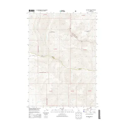
2013 Map of Big Creek Peak
USGS Topo · Published 2013About this map
The Lemhi Range dominates this portion of the Idaho interior, where the high-elevation terrain is split between the Challis National Forest and Salmon National Forest. The landscape is defined by the significant peak of Big Creek Peak and the nearby Flatiron Mtn, serving as a drainage divide for numerous mountain streams. The watershed network is remarkably detailed, tracing the headwaters of Big Timber Creek and the various branches of the Big Creek system, including the North Fork and South Fork. Human presence is concentrated along the few access points like Big Creek Road and the Big Creek Campground. The map also captures the political geography of the region, specifically where the border between Lemhi and Custer counties traverses these remote ridges.
Find a feature on this map
28 named features on this map. Tap any name to fly to it.
Don’t see what you’re looking for? This feature index may not catch every label — zoom into the map to look around manually.
Map Details
Editions of this 2013 Big Creek Peak Map
This is the sole edition of this map. No revisions or reprints were ever made.
Other maps of this area

1935 · Borah Peak
USGS Topo · 1:125,000

1938 · Borah Peak
USGS Topo · 1:125,000

1955 · Dubois
USGS Topo · 1:250,000

1956 · Leadore
USGS Topo · 1:62,500

1956 · Patterson
USGS Topo · 1:62,500

1956 · Donkey Hills
USGS Topo · 1:62,500

1957 · Gilmore
USGS Topo · 1:62,500

1958 · Dubois
USGS Topo · 1:250,000

1980 · Leadore
USGS Topo · 1:100,000
1987 · Iron Creek Point
USGS Topo · 1:24,000