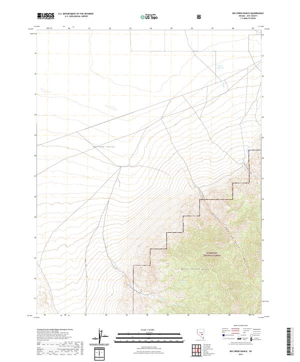
2021 Map of Big Creek Ranch
USGS Topo · Published 2021About this map
Railroad Valley marks the lower elevations of this high-desert landscape in Nye County, where the terrain rises sharply from the basin floor into the towering Quinn Canyon Range. Much of the eastern portion of the sheet is managed as part of the Humboldt National Forest, characterized by steep drainages and isolated water sources. The map documents vital hydrological features in an arid environment, including Antelope Spring and the Big Cr Reservoir, which captures flow from Big Cr. Steep topographical relief is evident through Big Creek Canyon and Deep Creek Canyon, the latter of which is traversed by the Deep Creek Canyon Trl. These trails and canyons represent the primary corridors through the high-elevation wilderness, connecting the valley floors to the protected interior of the national forest.
Find a feature on this map
16 named features on this map. Tap any name to fly to it.
Don’t see what you’re looking for? This feature index may not catch every label — zoom into the map to look around manually.
Map Details
Editions of this 2021 Big Creek Ranch Map
This is the sole edition of this map. No revisions or reprints were ever made.
Other maps of this area

1956 · Lund
USGS Topo · 1:250,000

1960 · Lund
USGS Topo · 1:250,000

1964 · Troy Canyon
USGS Topo · 1:62,500

1968 · The Wall
USGS Topo · 1:62,500
1968 · The Wall SE
USGS Topo · 1:24,000
1968 · The Wall SW
USGS Topo · 1:24,000
1985 · Eds Well
USGS Topo · 1:24,000
1985 · Goat Ranch Well
USGS Topo · 1:24,000
1985 · Goat Ranch Springs
USGS Topo · 1:24,000
1985 · Big Creek Ranch
USGS Topo · 1:24,000