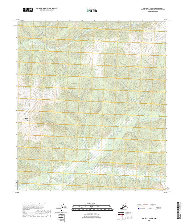
2024 Map of Big Delta A-1 SW
USGS Topo · Published 2024About this map
Healy Lake sits at the western edge of this interior Alaska landscape, where the seasonal rhythms of the water define the geography. The terrain is marked by the winding courses of the Healy River and the Volkmar River, which cut through the hills of the Southeast Fairbanks Census Area. This 2024 U.S. Geological Survey topographic map documents the natural drainage patterns and the township and range lines, such as t27n r5e and t26n r6e, which provide the only structural overlay on an otherwise roadless wilderness. The lack of built infrastructure or settlements highlighted on the sheet emphasizes the remote character of this region, which remains largely shaped by its river systems and traditional land boundaries.
Find a feature on this map
7 named features on this map. Tap any name to fly to it.
Don’t see what you’re looking for? This feature index may not catch every label — zoom into the map to look around manually.
Map Details
Editions of this 2024 Big Delta A-1 SW Map
This is the sole edition of this map. No revisions or reprints were ever made.
Other maps of this area

1950 · Mount Hayes
USGS Topo · 1:250,000

1950 · Big Delta
USGS Topo · 1:250,000

1951 · Big Delta
USGS Topo · 1:250,000

1951 · Mount Hayes
USGS Topo · 1:250,000

1954 · Mount Hayes D-2
USGS Topo · 1:63,360

1954 · Mount Hayes D-1
USGS Topo · 1:63,360

1954 · Big Delta A-2
USGS Topo · 1:63,360

1955 · Big Delta A-1
USGS Topo · 1:63,360

1955 · Big Delta A-2
USGS Topo · 1:63,360

1955 · Mount Hayes D-2
USGS Topo · 1:63,360