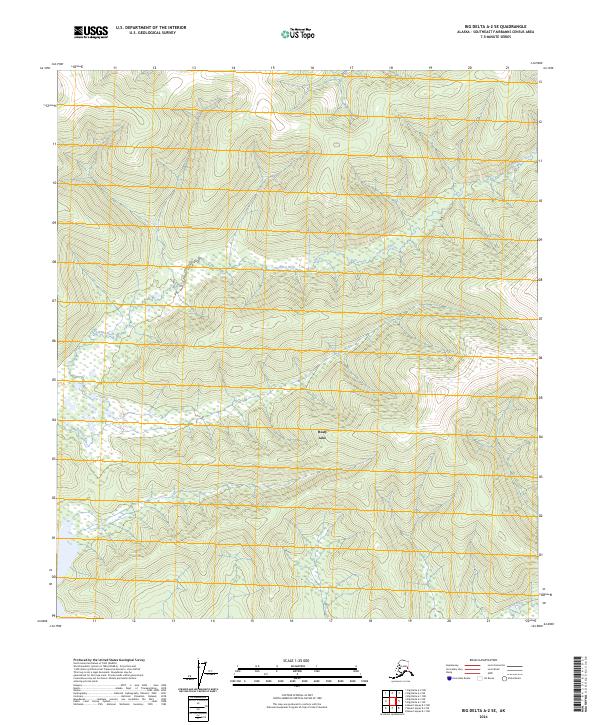
2024 Map of Big Delta A-2 SE
USGS Topo · Published 2024About this map
Healy Lake sits at the heart of this interior Alaskan landscape, serving as a primary hydrological focal point in the Southeast Fairbanks region. The area is defined by the winding course of the Volkmar River as it traverses the northern sections of the quadrangle, eventually giving way to the complex wetlands surrounding the lake. In the southern reaches, the Healy River cuts through the terrain, further emphasizing the importance of these waterways to the local geography. The map displays the underlying Public Land Survey System grid, including boundaries for t9s r16e and t10s r16e, which organize this largely undeveloped wilderness. The concentration of water features amidst the topographic contours suggests a landscape where movement and history have long been tied to the river systems and the seasonal cycles of the lake basin.
Find a feature on this map
8 named features on this map. Tap any name to fly to it.
Don’t see what you’re looking for? This feature index may not catch every label — zoom into the map to look around manually.
Map Details
Editions of this 2024 Big Delta A-2 SE Map
This is the sole edition of this map. No revisions or reprints were ever made.
Other maps of this area

1950 · Mount Hayes
USGS Topo · 1:250,000

1950 · Big Delta
USGS Topo · 1:250,000

1951 · Big Delta
USGS Topo · 1:250,000

1951 · Mount Hayes
USGS Topo · 1:250,000

1954 · Mount Hayes D-2
USGS Topo · 1:63,360

1954 · Mount Hayes D-1
USGS Topo · 1:63,360

1954 · Big Delta A-2
USGS Topo · 1:63,360

1955 · Big Delta A-1
USGS Topo · 1:63,360

1955 · Big Delta A-2
USGS Topo · 1:63,360

1955 · Mount Hayes D-2
USGS Topo · 1:63,360