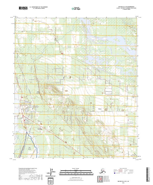
2024 Map of Big Delta A-4 SE
USGS Topo · Published 2024About this map
Big Delta and Delta Junction serve as the primary hubs in this interior Alaska region where the Tanana River meets the confluence of glacial meltwaters. The infrastructure is dominated by the corridor of the Alaska Pipeline, which runs parallel to the Richardson Highway past Fort Greely and its associated Allen Army Airfield. This military presence, established during the mid-20th century, remains a central feature of the landscape alongside the University of Alaska Fairbanks - Delta Junction campus. Agricultural and residential development is evident in the grid of roads such as Jack Warren Road and Remington Road that extend toward Deltana. Natural waterways like Clearwater Creek and Jarvis Creek intersect this man-made network, providing a backdrop for local landmarks including the Rest Haven Cem and several bush airfields such as the Delta Junction Airport.
Find a feature on this map
86 named features on this map. Tap any name to fly to it.
Don’t see what you’re looking for? This feature index may not catch every label — zoom into the map to look around manually.
Map Details
Editions of this 2024 Big Delta A-4 SE Map
This is the sole edition of this map. No revisions or reprints were ever made.
Other maps of this area

1950 · Mount Hayes
USGS Topo · 1:250,000

1950 · Big Delta
USGS Topo · 1:250,000

1950 · Mount Hayes D-4
USGS Topo · 1:63,360

1950 · Big Delta A-4
USGS Topo · 1:63,360

1951 · Big Delta
USGS Topo · 1:250,000

1951 · Mount Hayes
USGS Topo · 1:250,000

1952 · Mount Hayes D-4
USGS Topo · 1:63,360

1952 · Big Delta A-4
USGS Topo · 1:63,360

1954 · Mount Hayes D-3
USGS Topo · 1:63,360

1955 · Big Delta A-3
USGS Topo · 1:63,360