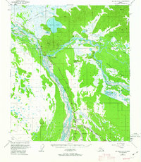
1962 Map of Big Delta A-4
USGS Topo · Published 1963About this map
Fort Greely anchors the southern portion of this interior landscape, marking a period of military presence near the confluence of major glacial rivers. The confluence of the Delta River and the Tanana River creates a complex network of braided channels and gravel bars, influencing the placement of early transportation routes. While the settlement of Big Delta (Aban'd) is noted as abandoned, the area remains a hub for travel via the Richardson Highway and the Alaska Highway.
Find a feature on this map
51 named features on this map. Tap any name to fly to it.
Don’t see what you’re looking for? This feature index may not catch every label — zoom into the map to look around manually.
Map Details
Editions of this 1962 Big Delta A-4 Map
This is the sole edition of this map. No revisions or reprints were ever made.
Other maps of this area

1949 · Big Delta B-5
USGS Topo · 1:63,360

1950 · Mount Hayes
USGS Topo · 1:250,000

1950 · Big Delta
USGS Topo · 1:250,000

1950 · Big Delta A-5
USGS Topo · 1:63,360

1950 · Mount Hayes D-4
USGS Topo · 1:63,360

1950 · Big Delta A-4
USGS Topo · 1:63,360

1950 · Mount Hayes D-5
USGS Topo · 1:63,360

1950 · Big Delta B-4
USGS Topo · 1:63,360

1951 · Big Delta
USGS Topo · 1:250,000

1951 · Mount Hayes
USGS Topo · 1:250,000