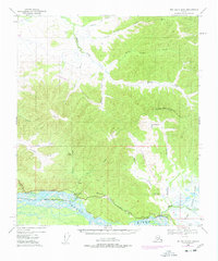
1949 Map of Big Delta B-5
USGS Topo · Published 1978About this map
The Tanana River anchors the southern edge of this interior landscape, which captures a critical moment of infrastructure expansion in the Fairbanks North Star Borough. While the primary topography is based on 1949 photogrammetry, the map highlights the significant 1970s arrival of The Trans-Alaska Pipeline, shown as under construction as it cuts across the northern ridges. This modern energy corridor contrasts with the older travel patterns along the Richardson Highway and the Tenderfoot Creek Highway, which follow the river's natural course.
Find a feature on this map
39 named features on this map. Tap any name to fly to it.
Don’t see what you’re looking for? This feature index may not catch every label — zoom into the map to look around manually.
Map Details
Editions of this 1949 Big Delta B-5 Map
3 editions found
Other maps of this area

1949 · Big Delta B-5
USGS Topo · 1:63,360

1949 · Big Delta B-6
USGS Topo · 1:63,360

1949 · Big Delta C-6
USGS Topo · 1:63,360

1949 · Big Delta A-6
USGS Topo · 1:63,360

1950 · Big Delta
USGS Topo · 1:250,000

1950 · Big Delta A-5
USGS Topo · 1:63,360

1950 · Big Delta A-4
USGS Topo · 1:63,360

1950 · Big Delta B-4
USGS Topo · 1:63,360

1951 · Big Delta
USGS Topo · 1:250,000
1951 · Big Delta A-6
USGS Topo · 1:63,360