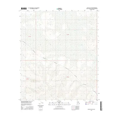
2016 Map of Big Delta B-5 NW
USGS Topo · Published 2016About this map
The Alaska Pipeline cuts a distinct path through the interior Alaskan wilderness in this modern survey, providing a contemporary perspective on the infrastructure that defines this part of the Fairbanks North Star Borough. The terrain is marked by a complex network of northern drainage systems, including Lenant Cr, Uncle Sam Cr, and McCoy Cr in the northern sections, while Gold Run and Minto Cr define the southern hydrology. These watercourses and their surrounding elevations suggest the rugged nature of the Tanana River valley's upper reaches, where topographic details from the Alaska Dept. of Transportation and the National Hydrography Dataset help delineate the landscape. The map captures the intersection of industrial engineering and wild terrain, offering a clear record of the region's physical geography and human impact in the early 21st century.
Find a feature on this map
11 named features on this map. Tap any name to fly to it.
Don’t see what you’re looking for? This feature index may not catch every label — zoom into the map to look around manually.
Map Details
Editions of this 2016 Big Delta B-5 NW Map
This is the sole edition of this map. No revisions or reprints were ever made.
Other maps of this area

1949 · Big Delta B-5
USGS Topo · 1:63,360

1949 · Big Delta B-6
USGS Topo · 1:63,360

1949 · Big Delta C-6
USGS Topo · 1:63,360

1950 · Big Delta
USGS Topo · 1:250,000

1951 · Big Delta
USGS Topo · 1:250,000

1952 · Big Delta C-6
USGS Topo · 1:63,360

1952 · Big Delta B-6
USGS Topo · 1:63,360

1952 · Big Delta B-5
USGS Topo · 1:63,360

1958 · Big Delta C-5
USGS Topo · 1:63,360

1958 · Big Delta
USGS Topo · 1:250,000