
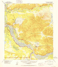
1952 Map of Big Delta B-6
USGS Topo · Published 1952About this map
The Tanana River floodplains and the high-latitude wetlands of interior Alaska are defined here by a series of prominent glacial lakes and military footprints. In the early 1950s, the Richardson Highway served as the primary terrestrial artery, connecting roadside landmarks like Aurora Lodge and Silver Fox Lodge to the surrounding wilderness. To the south, the expansive Ladd Air Force Base Bombing and Gunnery Range occupies a significant portion of the landscape, its Military Reservation Boundary tracing the braided channels of the Tanana. The survey captures a moment when the Military Rest Camp (Aban'd) near Birch Lake had already transitioned from its wartime role. This map documents a transitional period where recreational spaces like the Harding Lake Recreational Area began to coexist with industrial sites like the Gravel Pit and seasonal routes like the Winter Trail.
Find a feature on this map
25 named features on this map. Tap any name to fly to it.
Don’t see what you’re looking for? This feature index may not catch every label — zoom into the map to look around manually.
Map Details
Editions of this 1952 Big Delta B-6 Map
2 editions found
Other maps of this area

1949 · Big Delta B-5
USGS Topo · 1:63,360

1949 · Big Delta B-6
USGS Topo · 1:63,360

1949 · Fairbanks C-1
USGS Topo · 1:63,360

1949 · Big Delta C-6
USGS Topo · 1:63,360

1949 · Big Delta A-6
USGS Topo · 1:63,360

1949 · Fairbanks A-1
USGS Topo · 1:63,360

1950 · Fairbanks
USGS Topo · 1:250,000

1950 · Big Delta
USGS Topo · 1:250,000

1950 · Big Delta A-5
USGS Topo · 1:63,360

1950 · Fairbanks C-1
USGS Topo · 1:63,360