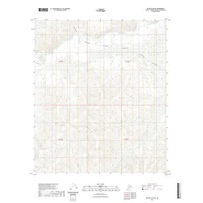
2021 Map of Big Delta B-6 NE
USGS Topo · Published 2021About this map
The Alaska Pipeline cuts a distinct path through this interior Alaska landscape, traversing the northern sections near the winding Salcha River. This modern industrial corridor contrasts with the primitive terrain, where the elevation rises significantly toward the south into unnamed peaks. The drainage network is defined by several key tributaries, including Redmond Cr, Mosquito Cr, and Shamrock Cr, which carve through the high ground. The map reflects a region primarily characterized by its remote hydrological features and the presence of critical energy infrastructure, with no established settlements or road networks indicated beyond the pipeline right-of-way itself.
Find a feature on this map
9 named features on this map. Tap any name to fly to it.
Don’t see what you’re looking for? This feature index may not catch every label — zoom into the map to look around manually.
Map Details
Editions of this 2021 Big Delta B-6 NE Map
This is the sole edition of this map. No revisions or reprints were ever made.
Other maps of this area

1949 · Big Delta B-5
USGS Topo · 1:63,360

1949 · Big Delta B-6
USGS Topo · 1:63,360

1949 · Big Delta C-6
USGS Topo · 1:63,360

1950 · Big Delta
USGS Topo · 1:250,000

1951 · Big Delta
USGS Topo · 1:250,000

1952 · Big Delta C-6
USGS Topo · 1:63,360

1952 · Big Delta B-6
USGS Topo · 1:63,360

1952 · Big Delta B-5
USGS Topo · 1:63,360

1958 · Big Delta C-5
USGS Topo · 1:63,360

1958 · Big Delta
USGS Topo · 1:250,000