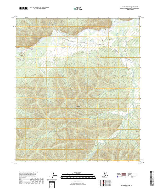
2024 Map of Big Delta B-6 NE
USGS Topo · Published 2024About this map
The Alaska Pipeline cuts a distinct path through this interior landscape, crossing the winding Salcha River as it traverses the northern portion of the quadrangle. This area in Fairbanks North Star Borough is defined by a dense network of tributaries, where Redmond Creek, Shamrock Creek, and Mosquito Creek drain the upland terrain. The presence of the Harding-Birch Lakes recreation area highlights the balance between industrial infrastructure and protected natural spaces. The map provides a precise view of the Public Land Survey System, showing the junctions of t5s r5e, t5s r6e, t6s r5e, and t6s r6e. These boundaries, combined with the prominent utility corridor, offer a clear picture of how modern resource management and land division are etched into the Alaskan wilderness.
Find a feature on this map
11 named features on this map. Tap any name to fly to it.
Don’t see what you’re looking for? This feature index may not catch every label — zoom into the map to look around manually.
Map Details
Editions of this 2024 Big Delta B-6 NE Map
This is the sole edition of this map. No revisions or reprints were ever made.
Other maps of this area

1949 · Big Delta B-5
USGS Topo · 1:63,360

1949 · Big Delta B-6
USGS Topo · 1:63,360

1949 · Big Delta C-6
USGS Topo · 1:63,360

1950 · Big Delta
USGS Topo · 1:250,000

1951 · Big Delta
USGS Topo · 1:250,000

1952 · Big Delta C-6
USGS Topo · 1:63,360

1952 · Big Delta B-6
USGS Topo · 1:63,360

1952 · Big Delta B-5
USGS Topo · 1:63,360

1958 · Big Delta C-5
USGS Topo · 1:63,360

1958 · Big Delta
USGS Topo · 1:250,000