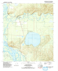
1992 Map of Big Delta B-6 NW
USGS Topo · Published 1992About this map
Harding Lake dominates the central landscape of this 1990s survey, surrounded by established recreational facilities including the Harding Lake State Recreation Area and various campgrounds. The map documents a corridor of transit and leisure where the Richardson Highway parallels the winding course of the Tanana River and the Salcha River. To the north, the steep elevation of Salcha Bluff provides a sharp contrast to the low-lying river tracts, while the Salcha River State Rec Site near Aurora Lodge marks a key access point for river travelers.
Find a feature on this map
25 named features on this map. Tap any name to fly to it.
Don’t see what you’re looking for? This feature index may not catch every label — zoom into the map to look around manually.
Map Details
Editions of this 1992 Big Delta B-6 NW Map
This is the sole edition of this map. No revisions or reprints were ever made.
Other maps of this area

1949 · Big Delta B-6
USGS Topo · 1:63,360

1949 · Fairbanks C-1
USGS Topo · 1:63,360

1949 · Big Delta C-6
USGS Topo · 1:63,360

1950 · Fairbanks
USGS Topo · 1:250,000

1950 · Big Delta
USGS Topo · 1:250,000

1950 · Fairbanks C-1
USGS Topo · 1:63,360

1950 · Fairbanks B-1
USGS Topo · 1:63,360

1951 · Big Delta
USGS Topo · 1:250,000
1951 · Fairbanks B-1
USGS Topo · 1:63,360

1951 · Fairbanks
USGS Topo · 1:250,000