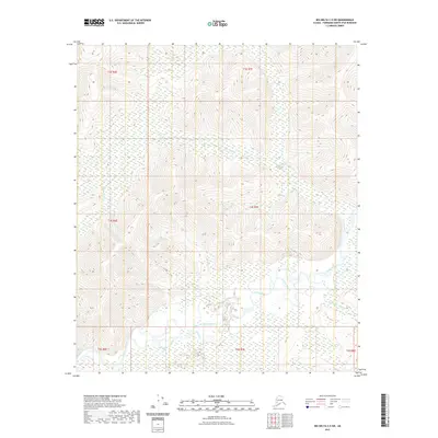
2021 Map of Big Delta C-5 SW
USGS Topo · Published 2021About this map
The Salcha River snakes through the southern portion of this interior Alaska wilderness, creating a complex drainage system characterized by numerous wetlands and side channels like Koepke Slough. This 2021 survey reveals a landscape largely defined by its waterways, with Ninetyeight Cr cutting across the central hills and the McCoy Cr drainage feeding into the main river valley from the south. The terrain transitions from high ridges in the north down toward the river's floodplains. To the east, Twentyfive Mile Cr joins the larger river system, marking a significant tributary junction. This map illustrates the natural hydrological patterns of the Fairbanks North Star region before major development, documenting the raw topography of the tanana valley highlands.
Find a feature on this map
12 named features on this map. Tap any name to fly to it.
Don’t see what you’re looking for? This feature index may not catch every label — zoom into the map to look around manually.
Map Details
Editions of this 2021 Big Delta C-5 SW Map
This is the sole edition of this map. No revisions or reprints were ever made.
Other maps of this area

1949 · Big Delta B-5
USGS Topo · 1:63,360

1949 · Big Delta B-6
USGS Topo · 1:63,360

1949 · Big Delta C-6
USGS Topo · 1:63,360

1950 · Big Delta
USGS Topo · 1:250,000

1951 · Big Delta
USGS Topo · 1:250,000

1952 · Big Delta C-6
USGS Topo · 1:63,360

1952 · Big Delta B-6
USGS Topo · 1:63,360

1952 · Big Delta B-5
USGS Topo · 1:63,360

1958 · Big Delta C-5
USGS Topo · 1:63,360

1958 · Big Delta
USGS Topo · 1:250,000