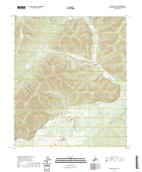
2024 Map of Big Delta C-5 SW
USGS Topo · Published 2024About this map
The Salcha River dominates the southern landscape of this interior Alaska quadrangle, carving a wide alluvial valley filled with complex wetlands and side channels like Koepke Slough. The drainage pattern reveals a transition from these low-lying riparian zones to the upland drainage systems of Ninetyeight Creek and Twentyfive Mile Creek. This area of the Fairbanks North Star Borough is characterized by its hydrological network, where the meandering river path suggests a dynamic environment of seasonal flow and sediment transport.
Find a feature on this map
12 named features on this map. Tap any name to fly to it.
Don’t see what you’re looking for? This feature index may not catch every label — zoom into the map to look around manually.
Map Details
Editions of this 2024 Big Delta C-5 SW Map
This is the sole edition of this map. No revisions or reprints were ever made.
Other maps of this area

1949 · Big Delta B-5
USGS Topo · 1:63,360

1949 · Big Delta B-6
USGS Topo · 1:63,360

1949 · Big Delta C-6
USGS Topo · 1:63,360

1950 · Big Delta
USGS Topo · 1:250,000

1951 · Big Delta
USGS Topo · 1:250,000

1952 · Big Delta C-6
USGS Topo · 1:63,360

1952 · Big Delta B-6
USGS Topo · 1:63,360

1952 · Big Delta B-5
USGS Topo · 1:63,360

1958 · Big Delta C-5
USGS Topo · 1:63,360

1958 · Big Delta
USGS Topo · 1:250,000