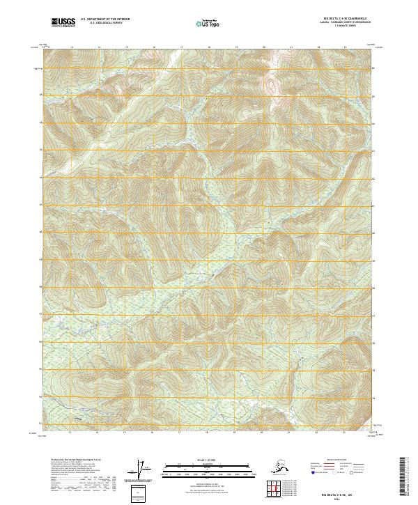
2024 Map of Big Delta C-6 SE
USGS Topo · Published 2024About this map
Salcha sits at the southern edge of this interior Alaska landscape, where the modern industrial footprint of the Alaska Pipeline cuts across the terrain. The map records the complex drainage patterns of the Little Salcha River and its various tributaries, including Ninetyeight Creek and French Creek. This contemporary survey reflects the managed wilderness of the Fairbanks North Star Borough, illustrating how transportation corridors like Johnson Road interact with the natural hydrography of the region. The spatial arrangement of these features shows the intersection of energy infrastructure and the traditional waterway systems that have long defined travel and settlement in the Alaskan interior.
Find a feature on this map
12 named features on this map. Tap any name to fly to it.
Don’t see what you’re looking for? This feature index may not catch every label — zoom into the map to look around manually.
Map Details
Editions of this 2024 Big Delta C-6 SE Map
This is the sole edition of this map. No revisions or reprints were ever made.
Other maps of this area

1949 · Big Delta B-5
USGS Topo · 1:63,360

1949 · Big Delta B-6
USGS Topo · 1:63,360

1949 · Big Delta C-6
USGS Topo · 1:63,360

1950 · Big Delta
USGS Topo · 1:250,000

1951 · Big Delta
USGS Topo · 1:250,000

1952 · Big Delta C-6
USGS Topo · 1:63,360

1952 · Big Delta B-6
USGS Topo · 1:63,360

1952 · Big Delta B-5
USGS Topo · 1:63,360

1958 · Big Delta C-5
USGS Topo · 1:63,360

1958 · Big Delta
USGS Topo · 1:250,000