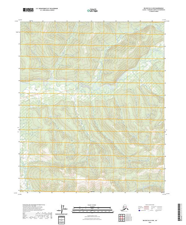
2024 Map of Big Delta D-4 NW
USGS Topo · Published 2024About this map
The Middle Fork Chena River winds through this interior Alaskan wilderness, serving as the central drainage for a network of high-elevation tributaries. This 2024 landscape is defined by its water systems, including Ottertail Creek and Wolverine Creek to the north, and Munson Creek to the south. Human imprints are sparse in this remote terrain, noted primarily by the East Fork Winter Trl which provides a seasonal route through the drainage basins. The map illustrates a primitive environment where land divisions like t2n r9e and t1n r10e overlay a landscape largely shaped by the natural flow of the river and its smaller feeders like Demur Creek and Anderson Creek.
Find a feature on this map
11 named features on this map. Tap any name to fly to it.
Don’t see what you’re looking for? This feature index may not catch every label — zoom into the map to look around manually.
Map Details
Editions of this 2024 Big Delta D-4 NW Map
This is the sole edition of this map. No revisions or reprints were ever made.
Other maps of this area

1950 · Big Delta
USGS Topo · 1:250,000

1951 · Big Delta
USGS Topo · 1:250,000

1951 · Circle
USGS Topo · 1:250,000

1951 · Circle A-5
USGS Topo · 1:63,360

1952 · Circle A-4
USGS Topo · 1:63,360

1952 · Circle A-5
USGS Topo · 1:63,360

1954 · Circle A-5
USGS Topo · 1:63,360

1955 · Circle
USGS Topo · 1:250,000

1958 · Big Delta D-5
USGS Topo · 1:63,360

1958 · Big Delta D-4
USGS Topo · 1:63,360