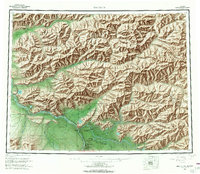
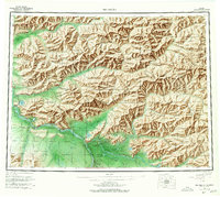
1958 Map of Big Delta
USGS Topo · Published 1967About this map
Big Delta and the strategically vital Delta Junction serve as the focal points for this mid-century topographic study of the Tanana Valley. This era represents a significant period of northern infrastructure development, highlighted by the intersection of the Richardson Highway and the Alaska Highway. The map illustrates the sprawling Fort Greely Military Reservation and the Big Delta Airport, underscoring the region's importance to national defense during the Cold War. Beyond the military footprint, the landscape is dotted with early lodges and camps such as Shaw Creek Lodge, Aurora Lodge, and Jollys Cabins, which supported travelers and hunters along the river corridors.
Find a feature on this map
86 named features on this map. Tap any name to fly to it.
Don’t see what you’re looking for? This feature index may not catch every label — zoom into the map to look around manually.
Map Details
Editions of this 1958 Big Delta Map
6 editions found

Other maps of this area

1945 · Livengood
USGS Topo · 1:250,000

1949 · Fairbanks D-1
USGS Topo · 1:62,500

1949 · Big Delta B-5
USGS Topo · 1:63,360

1949 · Big Delta B-6
USGS Topo · 1:63,360

1949 · Fairbanks C-1
USGS Topo · 1:63,360

1949 · Big Delta C-6
USGS Topo · 1:63,360

1949 · Tanacross
USGS Topo · 1:250,000

1949 · Big Delta A-6
USGS Topo · 1:63,360

1949 · Fairbanks A-1
USGS Topo · 1:63,360

1949 · Healy D-1
USGS Topo · 1:63,360