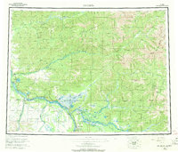
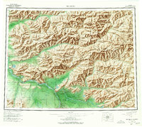
1958 Map of Big Delta
USGS Topo · Published 1970About this map
The confluence of the Tanana River and the Delta River serves as the focal point for this interior Alaskan landscape during the mid-20th century. This region, characterized by its complex network of waterways and expansive lowlands like the Shaw Creek Flats, shows the strategic importance of transportation and military presence in the territory's development. The Richardson Highway provides the primary overland link, connecting established nodes such as Big Delta and the growing hub at Delta Junction, while the expansive Military Reservation and Fort Greely indicate the area's significance for national defense.
Find a feature on this map
95 named features on this map. Tap any name to fly to it.
Don’t see what you’re looking for? This feature index may not catch every label — zoom into the map to look around manually.
Map Details
Editions of this 1958 Big Delta Map
6 editions found

Other maps of this area

1945 · Livengood
USGS Topo · 1:250,000

1949 · Fairbanks D-1
USGS Topo · 1:62,500

1949 · Big Delta B-5
USGS Topo · 1:63,360

1949 · Big Delta B-6
USGS Topo · 1:63,360

1949 · Fairbanks C-1
USGS Topo · 1:63,360

1949 · Big Delta C-6
USGS Topo · 1:63,360

1949 · Tanacross
USGS Topo · 1:250,000

1949 · Big Delta A-6
USGS Topo · 1:63,360

1949 · Fairbanks A-1
USGS Topo · 1:63,360

1949 · Healy D-1
USGS Topo · 1:63,360