
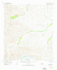
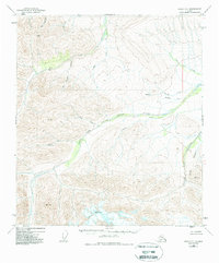
1949 Map of Healy D-1
USGS Topo · Published 1969About this map
The Little Delta River system dominates this 1949 topographic study, capturing a high-elevation landscape defined by glacial drainage and narrow tributary valleys. The survey, which was not field checked at the time of its initial aerial photography, shows a region largely devoid of permanent roads or infrastructure, save for isolated Cabins tucked away in the northern drainage of Dry Creek. The southern portion of the map is defined by the Fort Greely reservation, showing the early reach of military land use in the Alaska interior during the post-war era.
Find a feature on this map
14 named features on this map. Tap any name to fly to it.
Don’t see what you’re looking for? This feature index may not catch every label — zoom into the map to look around manually.
Map Details
Editions of this 1949 Healy D-1 Map
3 editions found
Other maps of this area

1949 · Big Delta A-6
USGS Topo · 1:63,360

1949 · Fairbanks A-2
USGS Topo · 1:63,360

1949 · Fairbanks A-1
USGS Topo · 1:63,360

1950 · Fairbanks
USGS Topo · 1:250,000

1950 · Mount Hayes
USGS Topo · 1:250,000

1950 · Big Delta
USGS Topo · 1:250,000

1950 · Mount Hayes D-6
USGS Topo · 1:63,360

1951 · Healy
USGS Topo · 1:250,000

1951 · Big Delta
USGS Topo · 1:250,000

1951 · Mount Hayes
USGS Topo · 1:250,000