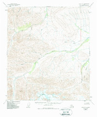
1949 Map of Healy D-1
USGS Topo · Published 1988About this map
The West Fork Little Delta River dominates this mid-century Alaskan landscape, cutting a wide path through high-altitude terrain marked by numerous triangulation stations. The eastern edge of the map includes a portion of Fort Greely, an area defined by steep drainages like Buchanan Creek. Human presence in this wilderness is sparse, indicated by isolated Cabins near Dry Creek and O'Brien Creek, alongside a remote Landing Strip located north of Whiskey Pup. The drainage patterns, including Snow Mountain Gulch and Red Mountain Creek, reveal a complex system of seasonal and permanent watercourses feeding into the larger river valley. Surveyors utilized high points such as VABM 8159 Marianne to chart this corner of the interior, documenting a landscape where aviation and foot travel were the primary means of navigation.
Find a feature on this map
23 named features on this map. Tap any name to fly to it.
Don’t see what you’re looking for? This feature index may not catch every label — zoom into the map to look around manually.
Map Details
Editions of this 1949 Healy D-1 Map
3 editions found
Other maps of this area

1949 · Big Delta A-6
USGS Topo · 1:63,360

1949 · Fairbanks A-2
USGS Topo · 1:63,360

1949 · Fairbanks A-1
USGS Topo · 1:63,360

1949 · Healy D-1
USGS Topo · 1:63,360

1950 · Fairbanks
USGS Topo · 1:250,000

1950 · Mount Hayes
USGS Topo · 1:250,000

1950 · Big Delta
USGS Topo · 1:250,000

1950 · Mount Hayes D-6
USGS Topo · 1:63,360

1951 · Healy
USGS Topo · 1:250,000

1951 · Big Delta
USGS Topo · 1:250,000