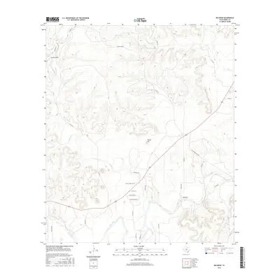
2016 Map of Big Draw
USGS Topo · Published 2016About this map
Gentry Creek Cem sits at the heart of this landscape where the Llano River and its various tributaries have carved a complex network of draws and creeks through the Texas Hill Country. This 2016 survey highlights the persistent rural character of Kimble County, showing the intersection of long-established ranching routes like Old Robbins Ranch Rd and local connectors such as Wooten Rd. The area is defined by its water sources, including the secluded Gorman Spring and the significant confluence of Johnson Fork with the main river channel. Local landmarks like Teacup Mtn provide vertical contrast to the drainage basins of Gentry Cr and Red Cr. Settled areas like Big Draw and the Jordan Conger property illustrate the modern-day distribution of homesteads and ranches along the county road system.
Find a feature on this map
32 named features on this map. Tap any name to fly to it.
Don’t see what you’re looking for? This feature index may not catch every label — zoom into the map to look around manually.
Map Details
Editions of this 2016 Big Draw Map
This is the sole edition of this map. No revisions or reprints were ever made.
Other maps of this area

1932 · Junction
USGS Topo · 1:62,500

1954 · Llano
USGS Topo · 1:250,000

1955 · Llano
USGS Topo · 1:250,000

1956 · Llano
USGS Topo · 1:250,000

1968 · London
USGS Topo · 1:24,000

1968 · Yates
USGS Topo · 1:24,000

1970 · Julio Draw
USGS Topo · 1:24,000

1970 · Brewer Hollow
USGS Topo · 1:24,000

1970 · Elm Slough
USGS Topo · 1:24,000
1970 · Big Draw
USGS Topo · 1:24,000