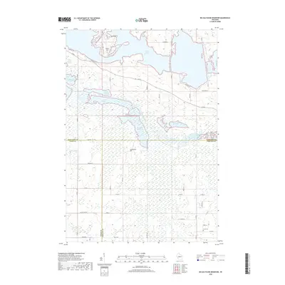
2018 Map of Big Eau Pleine Reservoir
USGS Topo · Published 2018About this map
Big Eau Pleine Reservoir dominates the northern landscape of this region, where the borders of Marathon, Wood, and Portage counties converge. The hydrology is defined by a sophisticated network of managed waters including the Little Eau Pleine River, Townline Reservoir, and series of flowages such as North Townline Flowage and Teal Flowage. This 2018 survey illustrates a rural landscape where recreation and water management intersect, featuring equestrian paths like the Outer Loop - Horse Trails and the Acorn Loop near East Point. Local topography is punctuated by elevations such as Maple Hill and Haumschild Hill. For genealogists and local historians, the presence of the Runkle Cem in the southeast corner provides a specific anchor for family research within this interconnected wetland and woodland environment.
Find a feature on this map
52 named features on this map. Tap any name to fly to it.
Don’t see what you’re looking for? This feature index may not catch every label — zoom into the map to look around manually.
Map Details
Editions of this 2018 Big Eau Pleine Reservoir Map
This is the sole edition of this map. No revisions or reprints were ever made.
Other maps of this area

1899 · Wausau
USGS Topo · 1:125,000

1902 · Wausau
USGS Topo · 1:125,000

1902 · Marathon
USGS Topo · 1:125,000

1953 · Wausau
USGS Topo · 1:48,000

1953 · Marathon
USGS Topo · 1:48,000

1955 · Green Bay
USGS Topo · 1:250,000

1956 · Milladore
USGS Topo · 1:48,000

1956 · Stevens Point
USGS Topo · 1:48,000

1963 · Marathon
USGS Topo · 1:62,500

1963 · Wausau
USGS Topo · 1:62,500